Tactical Urbanism
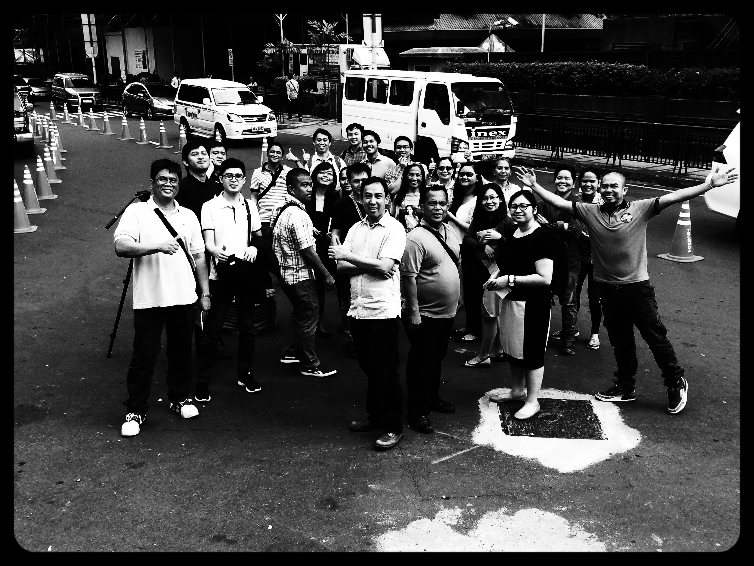
Tactical urbanism refers to a temporary alteration of the public realm in order to visualize the outcome in situ. The installation can be an hour or a week. We use it for training, design, and outreach. Typically we use traffic cones, paint, flexible bollards, chairs, plants - anything that would capture the spirit of the place.

Texas A&M University (USA), 2021
Demonstration project at Texas A&M University, intersection of Bizzell St and Polo Rd. The cones show how the intersection can be “tightened” up to make it easier to cross the street, slow turn drivers, and still process vehicles.

Cairo (Egypt) 2018
We preformed a tactical urbanism exercise in Cairo during August of 2018 at Mohamed Naguib Square (https://goo.gl/maps/m71ZUnfmB3y) in downtown Cairo to test a bike lane and wider sidewalks.

Buenos Aires (Argentina) 2017
On 23 November 2017, we organized a street design tactical urbanism exercise with orange cones in Buenos Aires. The location was the complex, 6-way intersection of Avenida Marin Garcia, Upsullata, Defensa, Pilcomayo and Avenida Regimiento de Patricios (https://goo.gl/maps/6gTyd6Cs7mB2). On the southwest corner of Park Lezama, the intersection has numerous bus turns, 1- and 2-way direction streets, bike lanes, and diagonal crosswalks.
The exercise was to visualize street geometry options, as part of a larger street design training workshop for city staff. We tested enlarging an existing island, closing a slip lane, adding pedestrian safety islands in the median, and repurposing excess space. Some of the options could be combined, and some could be taken individually. As always, the idea in training designing is to have them experience the design first-hand, observe user reaction, understand the limits of design, and iterate possibilities.

Jakarta (Indonesia) 2017
In September 2017, we organized a street design and TOD workshop in the Blok M neighborhood of Jakarta. Workshop participants participated in a tactical urbanism exercise at the intersection of Jalan Gandaria Tengah 3, Jalan Barito I, and Jalan Melawai, adjacent to Taman Ayodya. GPS coordinates: -6.245765, 106.794263.
We remade the intersection in three ways: a larger roundabout, pedestrian safety islands, and extended curbs. Photos and videos are below. The point of this exercise was to show workshop participants how streets could be changed (move the curb), how much excess asphalt there was a this particular junction, and to observe traffic flow with the remade junction. Participants agreed that the most effective intervention was the pedestrian safety islands, largely because they provided space to wait while crossing the street. Ultimately, some combination of the three would create the most successful design.

Miami FL (USA) 2016
As part of the workshop to redesign South First Street, we performed a tactical urbanism exercise. Watch the people get off the bus and cross the street.
from miamidda.com:
“The Miami DDA partnered with Miami Dade County and City of Miami to advance a Complete Streets concept and implementation plan for SE/SW 1st street between Biscayne Boulevard and SW 2nd Avenue in response to the 2015 U.S. Department of Transportation’s Mayor’s Challenge for Safer People and Safer Streets. A design workshop was held the first week of April 2016 where all key stakeholders were engaged and given the opportunity to provide input through this process. The plans aimed to address pedestrian safety and connectivity through context sensitive design with an emphasis in moving people rather than only cars, in order to create a more walkable, livable downtown.”
project website with more info and press hits
#SESW1ST

México City (Mexico) 2014
Calz. Legaria in Delegácion Miguel Hidalgo is a six-lane road with a tree-lined median. Between the Panteón Francés and Santa Cruz Calcalco Roundabouts there is a children’s hospital (Hospital Pedriatico Legaria) and school for the elderly (Universidad de Vida Para Adultos Mayores). The local officials desired a safer way to cross the street, and better access to the cemtral median.
We installed cones to decrease the amount of asphalt given to vehicles, and create pinch points where people could cross more easily.
press: SBD Noticias

Florianópolis (Brasil) 2014
As part of a two week long training workshop, we demonstrated the ability to move the curb with cones at the intersection of Rua Esteves Jr, Rua São Francisco, and Antônio Dib Mussi in downtown Florianópolis. The exercise demonstrated the simiplicity and logicalaity of traffic calming. Esteves Jr. is a main walking street in downtown Floripa, connecting the bus terminal with the north shore. Both the sidewalks and roadway vary in width. We used traffic cones to test wider sidewalks and curb extensions. This made it more comfortable to walk, safer to cross the street, and clarified traffic flow. We created “parklets” and interviewed local merchants and the public.
It was the first time that we used a drone to film a cone exercise.
The work was part of PLAMUS, the sustainable urban mobility plan for Florianópolis.

Buenos Aires (Argentina) 2013
The intersection of Av. Corrientes and Av. Scalabrini Ortiz in Buenos Aires had one of the worst crash records in the city. So we redesigned it and tested the design with cones. We tested a wider sidewalk, pedestrian refuge island, better aligned lanes, and tighter turns. The video shows how vehicles move through the intersection with cones. It even shows how the bus driver can make the turn, and a motorcyclist yielding to people in the crosswalk!!
The intersection was rebuilt in 2015.

Santa Monica CA (USA), Longfellow St, 2008
We designed Longfellow Street to be a “shared street” with a 14-foot wide “roadway”. To make sure that this width would accommodate larger vehicles, the incredibly progressive fire department was kind enough to spend the afternoon driving around traffic cones. It passed (we actually placed the cones 13 feet apart). There is nothing like getting out in the field to proof your work.
The design was implemented in 2012.

Great Streets Pilot, St Louis MO (USA) 2008
Testing a 4 to 3 road diet.

Manhattan NY (USA) 1997
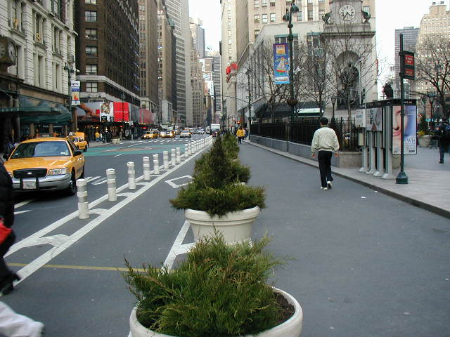
Early version of the remaking of Herald Square.

Manhattan NY (USA) 1996
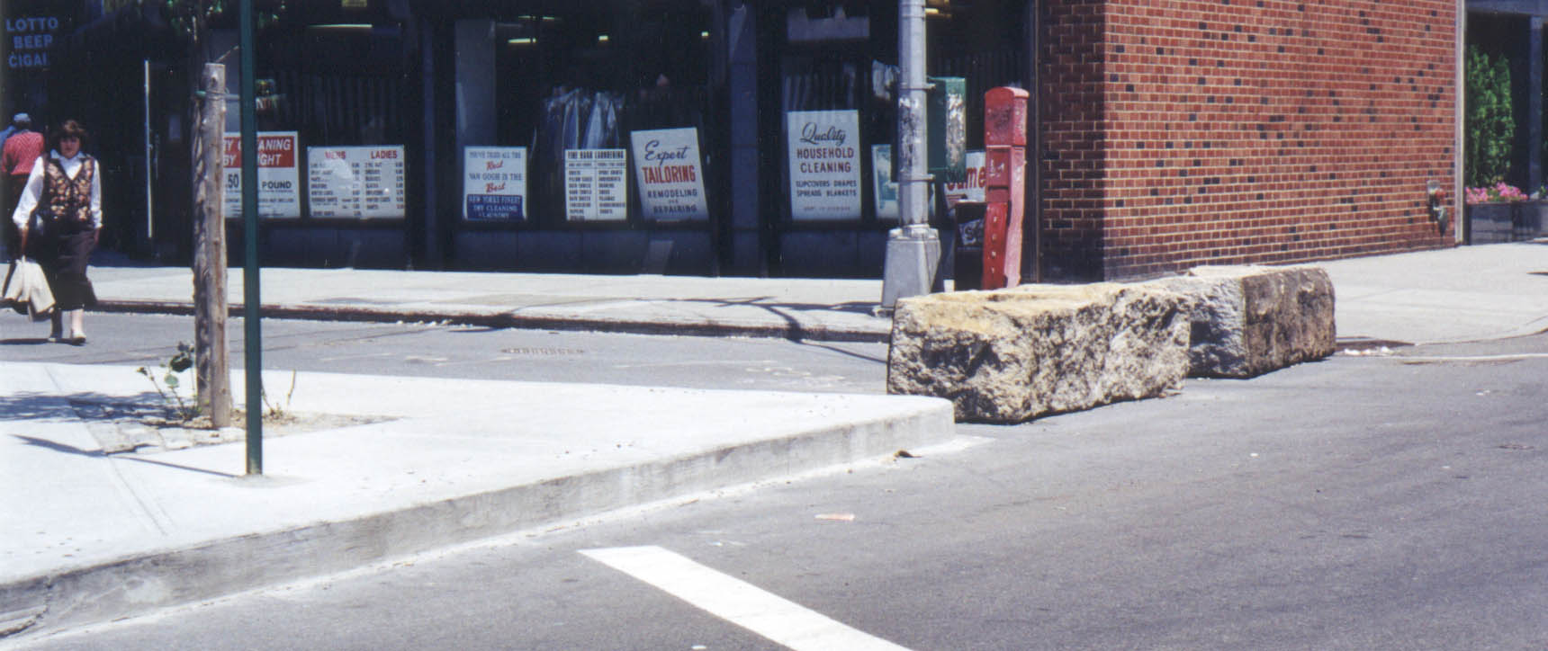
Using granite blocks (from the reconstruction of the Manhattan Bridge) to instantly close a street in Greenwich Village.
