Urban Design
Urban design has been described as making what is going to happen better. From the mobility angle, it is about the relationship of the building to the street, and the development to the network.
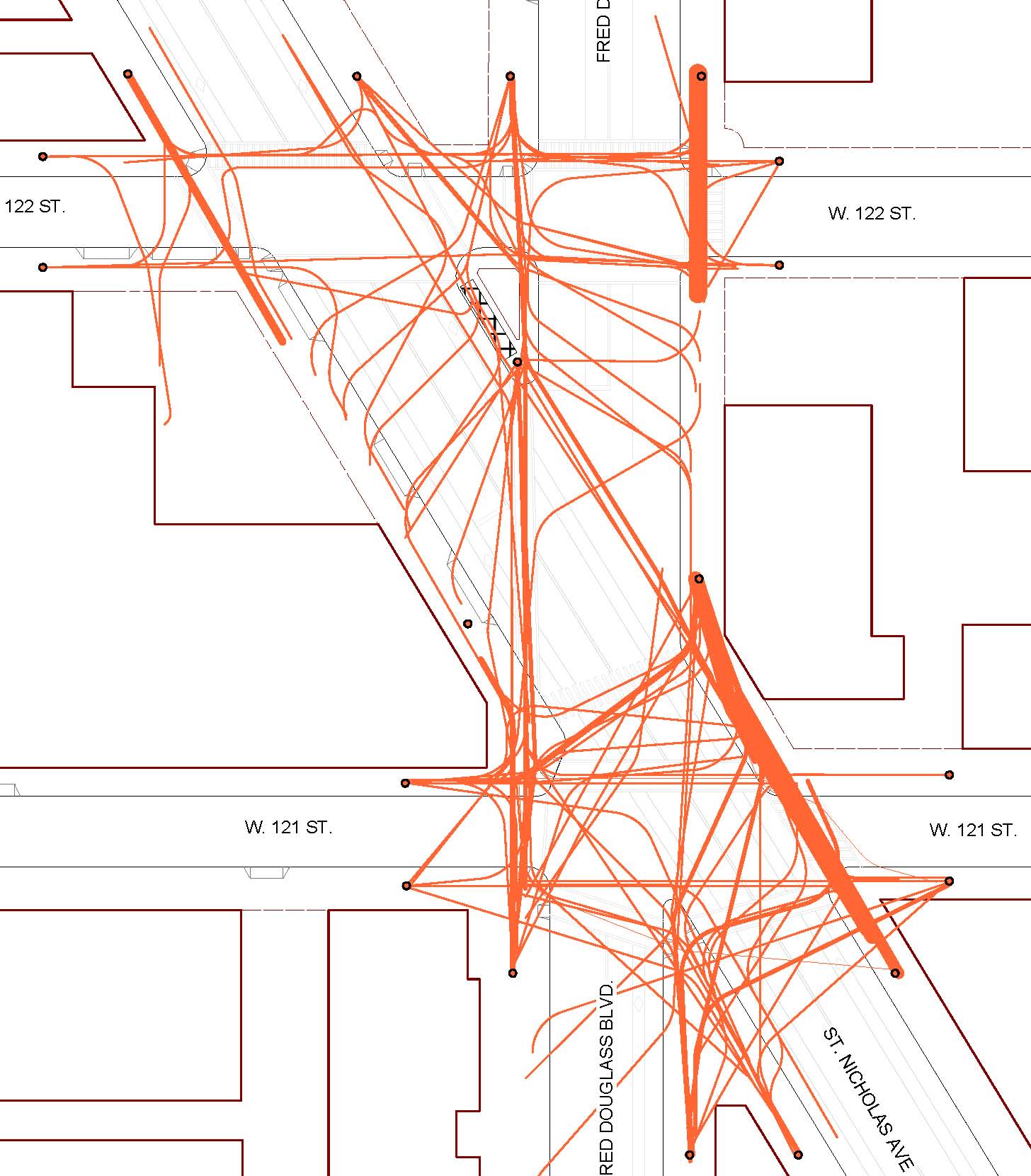
Tracking survey
This graphic records where people walk at Harriet Tubman Triangle in Manhattan NY. Called a “tracking” survey, observers stand at the periphery of the location (the black dots) and record exactly where people walk. Each line represents seven people. We use this to understand how people use a space so that we might design it better.
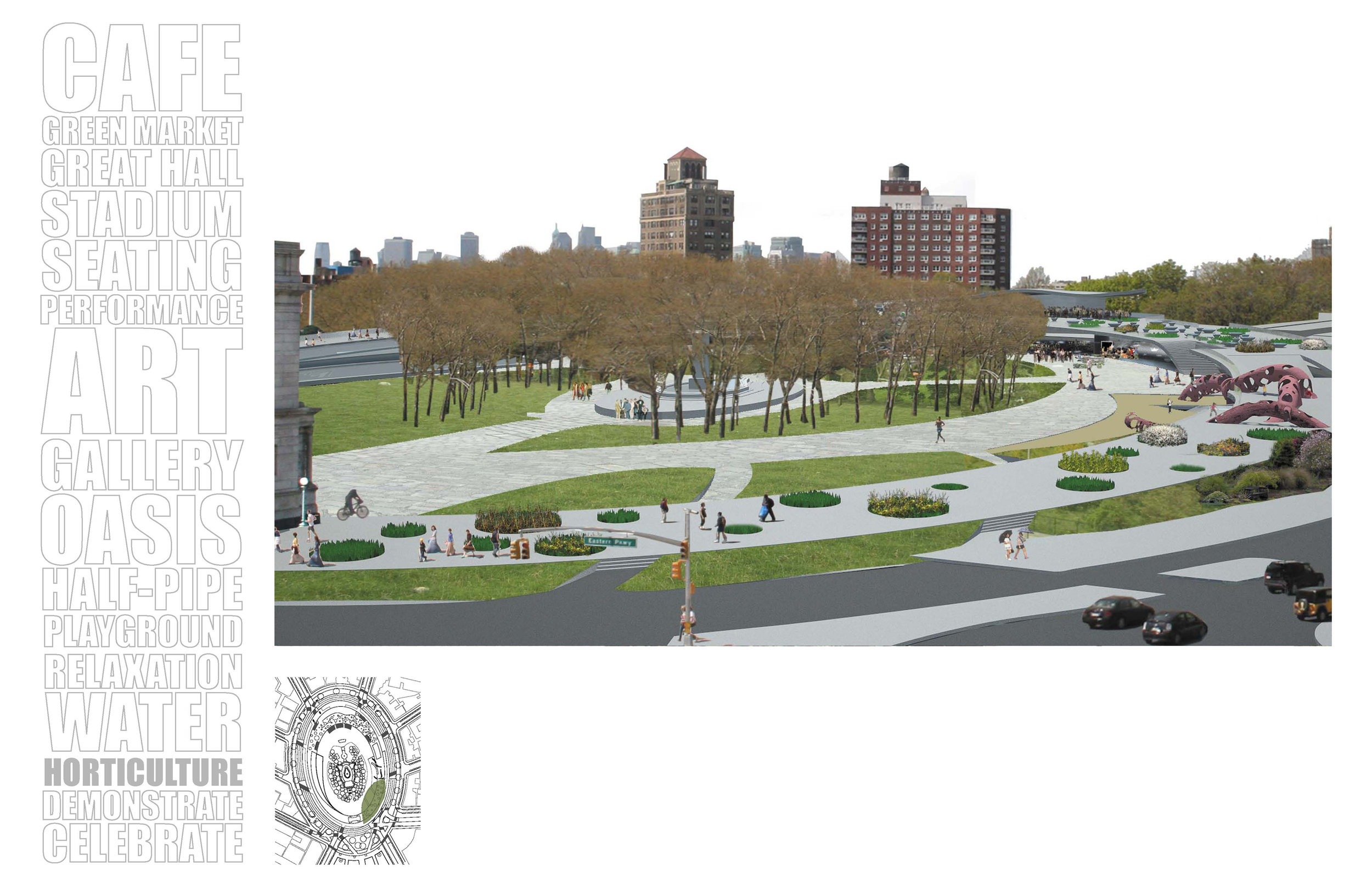
A Center for Brooklyn
Entry into the Reinventing Grand Army Plaza competition, Brooklyn NY. Placed Third and won People’s Choice Award.

Hudson River Arch Bridge, Manhattan Landing
Model exploring how a new bridge over the Hudson River would integrate into the area around West 42nd Street.
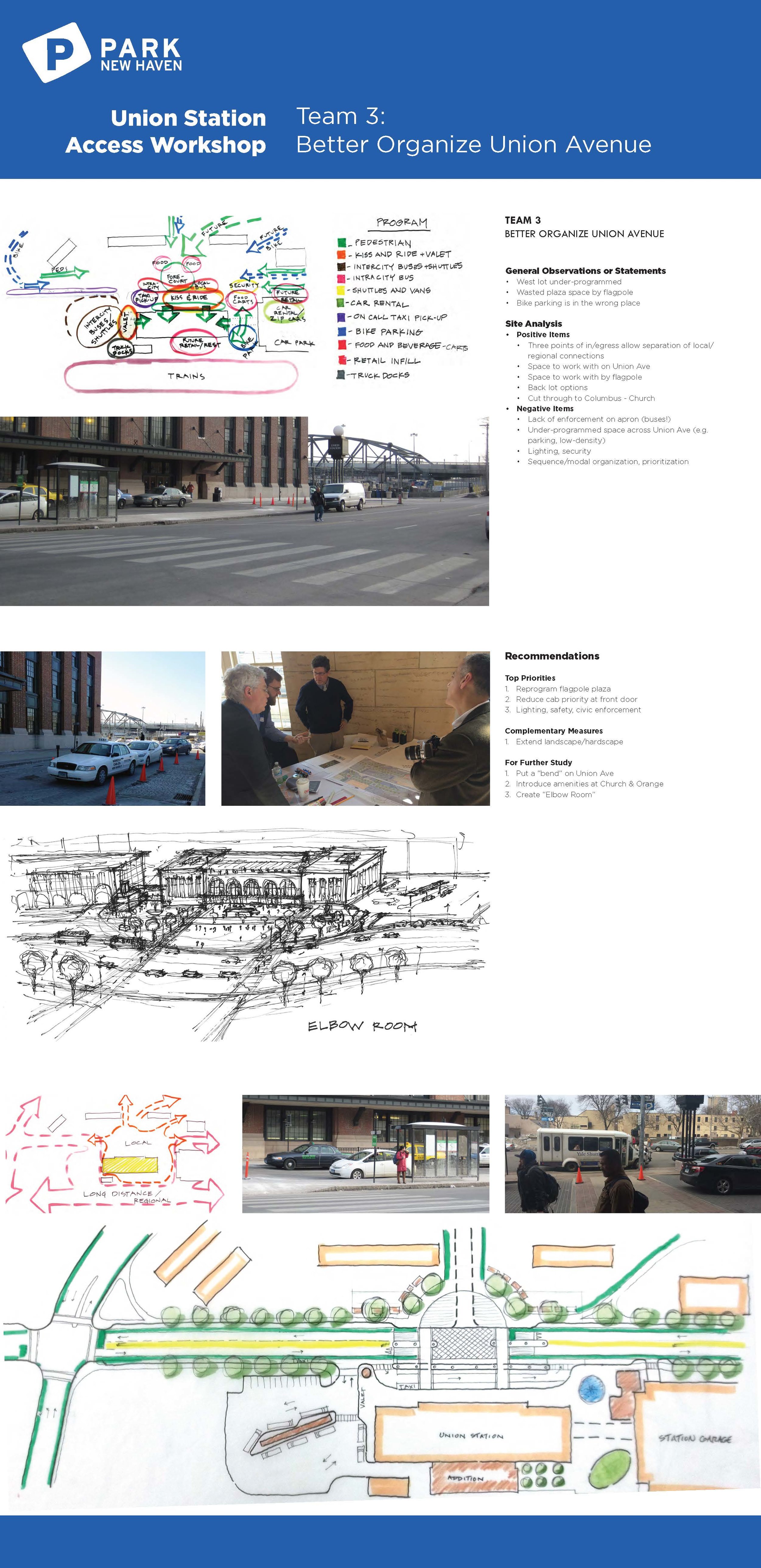
A Big Urban Room
Board is from a workshop to transform New Haven’s underutilized Union Station into a destination and anchor for the city’s Hill neighborhood. more information
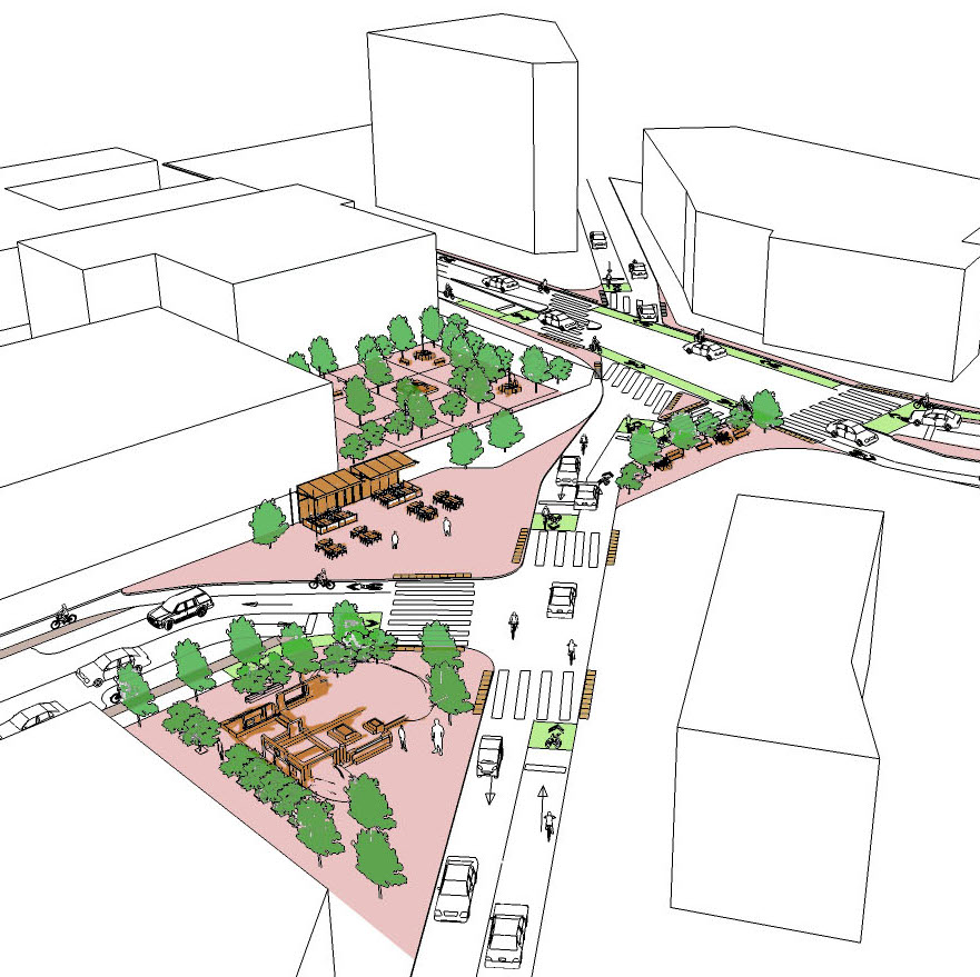
Intersection and urban design
This example from the NACTO USDG illustrates how the layout of the intersection affects the spatial understanding of the area.

Parking and urban design
This graphic from the Al Ain Central District Plan explores the relationship between the design of a parking lot, walking routes and urban design.
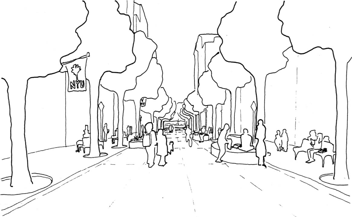
Street and urban design
This sketch explores how the removal of motorized vehicles from a street opens up urban design possibilities. From the Greenwich Village Traffic Calming Study.
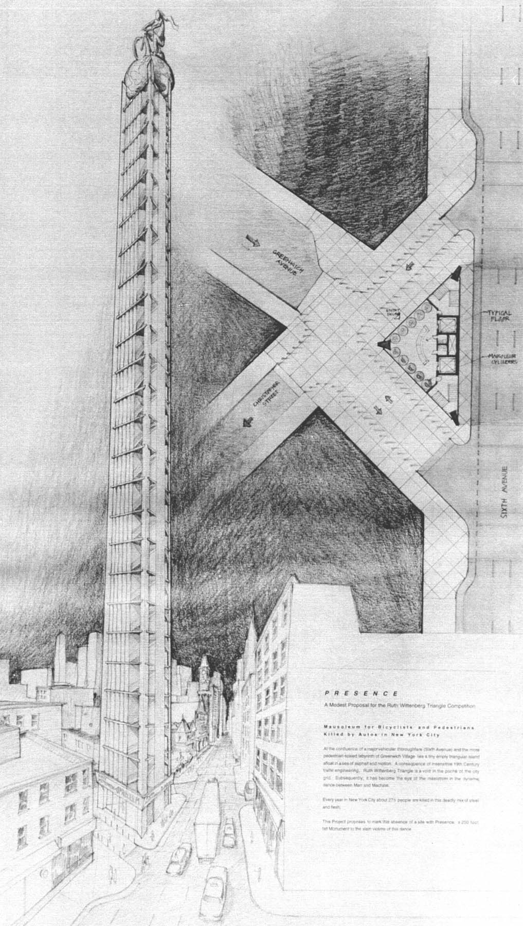
Presence
Entry for the New Visions for Ruth Wittenberg Triangle Competition, Manhattan NY. Dedicated to the lives of cyclists and pedestrians lost in traffic in New York City.
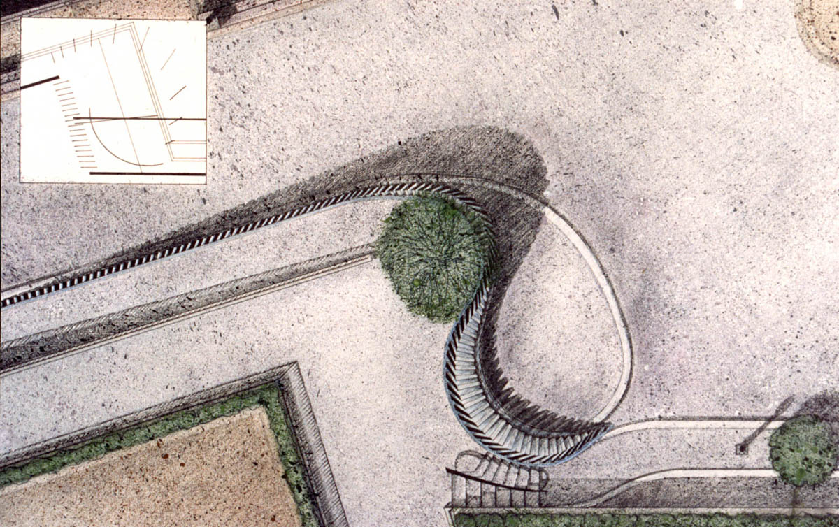
Police Memorial
Competition entry for a memorial to slain police officers in Battery Park City, Manhattan NY.
